
{{product.productLabel}} {{product.model}}
{{#if product.featureValues}}{{product.productPrice.formattedPrice}} {{#if product.productPrice.priceType === "PRICE_RANGE" }} - {{product.productPrice.formattedPriceMax}} {{/if}}
{{#each product.specData:i}}
{{name}}: {{value}}
{{#i!=(product.specData.length-1)}}
{{/end}}
{{/each}}
{{{product.idpText}}}

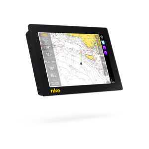
... fingers to capture a screenshot that will be saved directly to your micro SD card. CHART PLOTTER (WITH INTERNAL GPS ANTENNA) By using the incredibly rich C-MAP 4D charts, the GP-1871F/1971F ...
FURUNO France

A PREMIUM CHARTPLOTTER FOR THE ADVENTUROUS SPIRIT These chartplotters feature large, bright screens coupled with quick and easy-to-use keypad interfaces with user-programmable keys and multifunction ...
Garmin
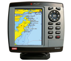
... GME G-Plot offers a simple to use highly featured GPS chartplotter. Incorporating a 16 channel internal GPS antenna for fast GPS updates, perspective view, animated navigation markers and plotter mode ...
GME electrophones
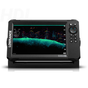
With razor sharp vision, the Eagle was born to fish. Get autotuning sonar, detailed C-MAP charts, and an always-visible IPS screen. That’s everything you need to dominate out on the water with total ease and no distractions. Enhanced ...
Lowrance
... to four screens. *Owner supplied Support variety charts of C-MAP (MAX), original chart, ENC chart. It also supports to overlay satellite images on the chart. AIS ...
Koden electronics
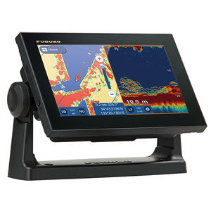
GPS/WAAS CHART PLOTTER with built-in CHIRP FISH FINDER 9" GPS Chart Plotter/Fish Finder with Tablet Control/Mirroring function Available. Wireless Connection to ...
Furuno
... smooth navigation interface. FEATURES Navigation The chartplotter NavXP is compatible with Navionics+ and Navionics Platinum+ charts, the world leaders in this field. Navionics charts ...
... you input waypoints and routes and view chart details with ease. Simple to add Waypoints and Routes Let Vulcan guide you safely to your destination: place waypoints and routes with a single tap on the chart ...
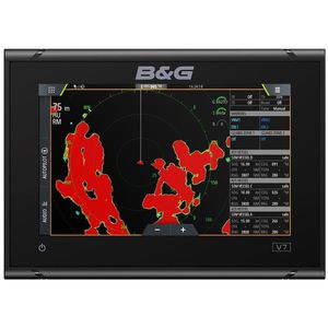
B & G
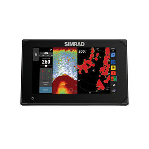
... experience to a whole new level with the Simrad® NSX smart chartplotter and fishfinder. With an innovative, modern interface featuring powerful navigation capability with C-MAP® DISCOVER X charts, you’ll ...
Simrad Yachting

The APEX 19 MEGA SI+ CHARTPLOTTER provides the clearest sonar imaging on the sharpest multi-function display that anglers have ever seen. Industry-leading MEGA Imaging+ and Dual Spectrum CHIRP sonar come standard, with ...
Humminbird
10" Color Sunlight Viewable WAAS GPS / C-Map MAX compatible Chart Plotter
Standard horizon
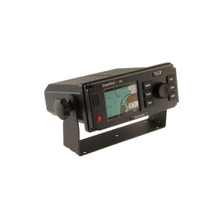
... equipped vessels on a chart overview display - without the need to connect to an external plotter. Designed to operate as a stand alone unit, the SMARTFIND M5 can also be integrated with ECDIS (Electronic ...
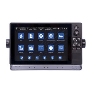
... WIFI and 4G network communication. · Support C-MAP (MAX) and S-63 chart format. XN60 series multi-function intelligent display integrates functional modules such as GNSS, chart plotter, ...
Xinuo Information Technology (Xiamen) Co.,Ltd
... 100 Routes, with up to 100 points each • Tracks : By time or distance, 10 track of 15,000 points • Chart datums : 216 Chart datums (see next page) • Chart scale : 0.2 ~ 500 nm • Interface ...
Navis USA LLC
Not just a chartplotter. A completely new user experience.To facilitate a new way of boating, we have completely rethought the way you interact with the boat. Inspired by the automotive and handheld smartdevice industries, ...
the best suppliers
Please specify:
Help us improve:
remaining