
{{product.productLabel}} {{product.model}}
{{#if product.featureValues}}{{product.productPrice.formattedPrice}} {{#if product.productPrice.priceType === "PRICE_RANGE" }} - {{product.productPrice.formattedPriceMax}} {{/if}}
{{#each product.specData:i}}
{{name}}: {{value}}
{{#i!=(product.specData.length-1)}}
{{/end}}
{{/each}}
{{{product.idpText}}}
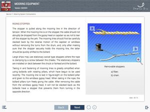
... E-learning modules (ELM) library is designed for theoretical training of Ratings as Able Seafarer Deck and ratings forming part of a navigational watch (RFPNW).
Content:
- Signs of ship classification
- Steering gear
- Anchor
STORM SIM
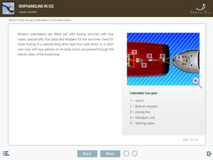
... E-learning modules (ELM) library Shiphandling basics is designed for theoretical training of navigators in accordance with Chapter II of the STCW Convention in the part concerning shiphandling.
Content:
- Ship
STORM SIM

... E-learning modules (ELM) are designed for theoretical training of seafarer in accordance with Chapter V of the STCW Convention in the part concerning of passengers safety, cargo safety and hull integrity. E-learning module is the electronic textbook ...
STORM SIM
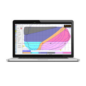
... optimisation and performance analysis expertise to target the shipping sector. This marked the launch of AdrenaShip software. This software provides marine transport professionals with a navigation decision-making ...

... Qinertia PPK software offers an all-new level in high-precision positioning solutions. In a world that demands accuracy without compromise, our software is emerging as the cornerstone for professionals and industries ...
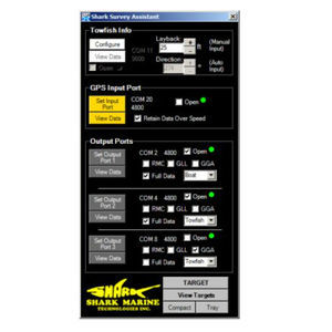
... Assistant is a bridging software, useful in a wide range of marine surveying applications. The SSA takes a GPS input and distributes that information to three separate ports can be connected to other surveying or navigation software. More ...
the best suppliers