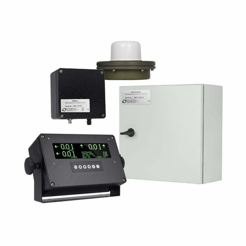
Ship speed log GEOLOGdigitaldual-axis
Add to favorites
Compare this product
Characteristics
- Application domain
- for ships
- Display
- digital
- Technology
- dual-axis
Description
The GEOLOG is a satellite-based replacement for a traditional ship’s Dual Axis log. It calculates fore and aft and athwart ships ground speed in the direction of the ships heading.
The speed information is displayed on the X991 displays. And also, may be distributed for use by RADAR and ECDIS, etc.
In addition to displaying and distributing the dual axis ground speed, the GEOLOG gives position. COG and SOG with accuracy better than standard GPS along with gyro heading. Also, if available NMEA from the vessels EM/Speed LOG also speed through water.
The combination of GPS and GLONASS satellites achieves high accuracy measurement of speed. GEOLOG has the added advantage of being relatively unaffected by pitch and roll. Also it suffers no issues from turbulence in the water, such as that found during use of thrusters or when being pushed/pulled by tugs.
In addition, GEOLOG provides accurate position fixes from the sensor and distance run record for ground track.
Mean Velocity is better than +/- 0.01 knots 95% 0.03 knots
Position accuracy 95% better than +/-16 metre
Catalogs
No catalogs are available for this product.
See all of AMI Marine Ltd‘s catalogs*Prices are pre-tax. They exclude delivery charges and customs duties and do not include additional charges for installation or activation options. Prices are indicative only and may vary by country, with changes to the cost of raw materials and exchange rates.


