
- Products
- Catalogs
- News & Trends
- Exhibitions
Ship radar NXATAwith ECDIScolor

Add to favorites
Compare this product
Characteristics
- Application domain
- for ships
- Type
- ATA
- Other characteristics
- with ECDIS, color
Description
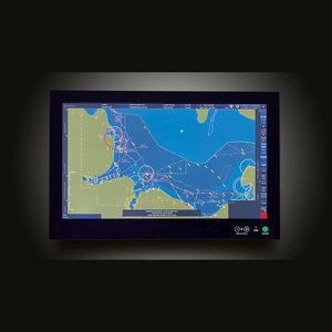
Working with ECDIS has never been so easy!
An Electronic Chart Display and Information System (ECDIS) displays the information from Electronic Navigational Charts (ENC) and integrates multiple sensor information into a common display for maximum level of awareness.
The first „user-defined“ ECDIS application, designed under continuous feedback from navigators. This makes the ECDIS NX intuitive to operate and it effectively supports the daily tasks and use cases of navigators.
Intuitive to operate thanks to a modern, clear structured UI.
Multi-touch and intuitve interaction patterns like point-to-chart, drag and drop or retractable panels
Quick access bar and wizard guided workflows for standard use cases
Embedded online user manual and free online type-specific ECDIS training
Better situational awareness, less workload, ongoing compliance.
Retractable panels maximize view of the chart
Quick access bar for essential functions
Smart tools for voyage management, such as Wizard based route planning
ETA calculation and speed of advance (SOA) for individual waypoints
Graphical editing of routes, supported through intuitive interaction patterns
Editable look ahead zones for anti-collision, route monitoring and anti-grounding
Filtering tools to reduce unnecessary alarms
Support of Admiralty Information Overlay (AIO)
VIDEO
Catalogs
Exhibitions
Meet this supplier at the following exhibition(s):

Related Searches
- Magnetic compass
- Steering compass
- Magnetic steering compass
- Ships radar
- Autopilot
- Standard autopilot
- ARPA radar
- Color radar
- Repeater
- Electronic compass
- Compass repeater
- Ship repeater
- Ship autopilot
- Ship steering compass
- Vertical steering compass
- Electronic gyrocompass
- Gyrocompass
- Analog repeater
- ECDIS
- Integrated bridge system
*Prices are pre-tax. They exclude delivery charges and customs duties and do not include additional charges for installation or activation options. Prices are indicative only and may vary by country, with changes to the cost of raw materials and exchange rates.


