- Equipment
- Marine Electronics
- Boat receiver
- Comar Systems
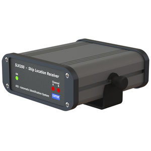
Boat receiver SLR200AISmarine chart
Add to favorites
Compare this product
Characteristics
- Application domain
- for boat
- Function
- AIS, marine chart
Description
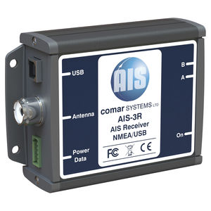
Designed for the light commercial, fishing and coastal monitoring markets. All models employ Dual Channel Parallel synthesised receivers with simultaneous decoding of all AIS data received.
Connected to a PC, via a serial port, running a compatible Navigation Program, or a dedicated Marine Chart Plotter, via the NMEA output, the information can be displayed on screen giving the operator a visual interpretation of the name, position, course and speed of AIS vessels within VHF range. Any NMEA input data at 4800 Baud can be connected into the unit, this is combined with the AIS data and will be output at 4800 or 38400 baud, avoiding the requirement of installing an external multiplexer.
THE SLR200 PROVIDES:
A low cost method of monitoring the position, speed and heading of other vessels within VHF range.
The ability to plot the progress, changes in heading and speed of other vessels on the screen of an onboard PC or Chart Plotter.
A vessels name, call sign and MMSI number to call up the target vessel on a DSC radio and ascertain their intentions.
INFORMATION RECEIVED:
Name of Vessel
MMSI Number
Position
Speed (SOG)
Course (COG)
Type of vessel
Call sign
Heading
Rate of Turn
Navigational Status
Vessel Dimensions
Catalogs
*Prices are pre-tax. They exclude delivery charges and customs duties and do not include additional charges for installation or activation options. Prices are indicative only and may vary by country, with changes to the cost of raw materials and exchange rates.


