- Water sports
- Diving, Spearfishing
- Diver navigation and location system with sonar
- Shark Marine Technologies
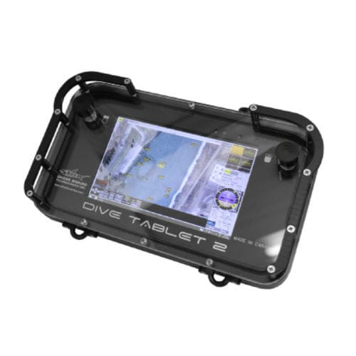
Diver navigation and location system with sonar DIVE TABLET 2
Add to favorites
Compare this product
fo_shop_gate_exact_title
Characteristics
- Options
- with sonar
Description
DIVE TABLET 2, our second generation of this product, is an affordable solution for anyone that requires accurate underwater positioning. Using advanced dead reckoning, GPS, DNS, or USBL, DIVE TABLET 2 allows operators to map underwater habitats, document archaeological sites, take geo-referenced photos and video, or accurately navigate underwater.
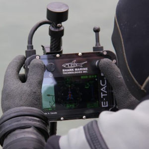
DIVE TABLET 2’s small size and rugged construction makes it a good fit for use on RHIBs and other surface vessels where it can be used for navigation, or to track and communicate with divers using the Sub-NET system.
Shark Marine’s DiveLog software provides a user friendly, intuitive interface managing all of the sensors and data, freeing the diver to focus on the dive.
Applications:
Underwater Navigation and Mapping
Rugged Topside Computer
Vessel Navigation
SAR Operations
Rapid Beach Profiling
Track / Communicate with Divers using Shark Marine’s Sub-NET
Evidence Documentation
Coral Research
Underwater Archaeology
Habitat Mapping
3D Photogrammetry
Geo-Referenced Photography
Catalogs
No catalogs are available for this product.
See all of Shark Marine Technologies‘s catalogsOther Shark Marine Technologies products
Diver Held Systems
Related Searches
- Professional video camera
- Video surveillance video camera
- Fixed video camera
- Metal video camera
- Night vision video camera
- Video camera with zoom
- Underwater video camera
- 12 V video camera
- ROV/AUV video camera
- Low-light video camera
- Digital video camera
- Stainless steel video camera
- NTSC video camera
- PAL video camera
- Aluminum video camera
- CCD video camera
- Video camera system
- Professional video camera system
- Diver navigation and location system
- Diver navigation and location system with sonar
*Prices are pre-tax. They exclude delivery charges and customs duties and do not include additional charges for installation or activation options. Prices are indicative only and may vary by country, with changes to the cost of raw materials and exchange rates.


